
Orientation signage

Orientation signage serves to guide and inform users throughout the route. The type and characteristics of the signage used are set out below.
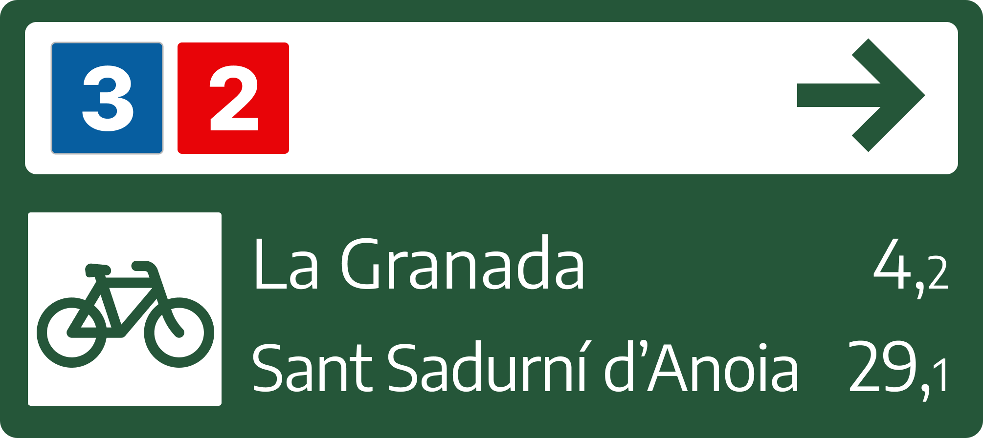

Directional signage

The sign contains an upper space where the icons of the routes are included (example: Route 2 and Route 3) and a lower space with the main destinations and their distance by bicycle.

The following are shown in this lower space:

  • Above, the nearest secondary destination (example: La Granada, 4.2 km away).
  • Below, the main or final destination (example: Sant Sadurní d’Anoia, 29.1 km).
Image
Senyalització de direcció
Image
Senyalització de seguiment

Trailing signage

Trailing signage is used to inform of the correct itinerary when a fork is reached. It can be found on stakes or marker posts.

Double trailing plates can also be used.

Wayfinding signage

Wayfinding signage indicates the direction to a point of interest. It may be a railway station, a town of a village, connections to other routes... .

These signs show the destination, the distance and an arrow indicating the direction.

Image
Senyaització d'encaminament

Safety and warning signage

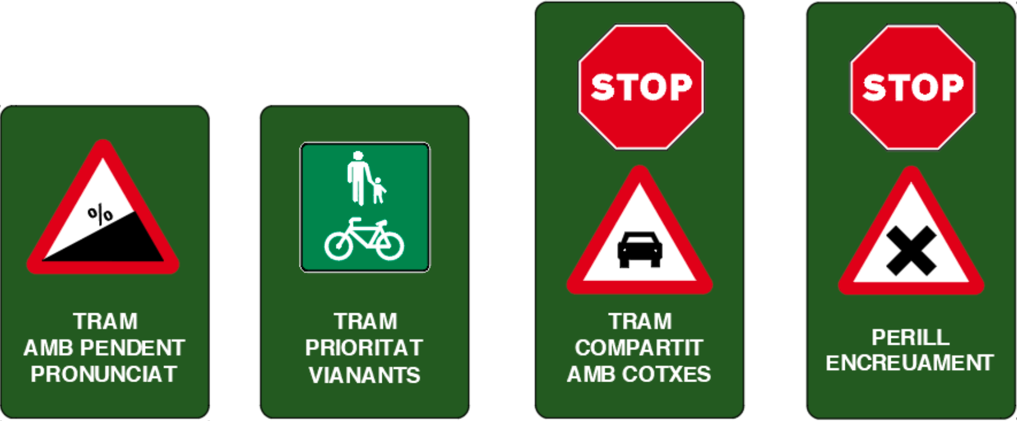
Specific plates are used for warning signage to alert users of steep sections, sections with pedestrian priority, sections shared with cars, and danger points due to crossings.

Image
Senyalitzacio

Horizontal signage

There are two types of horizontal signage: sharrows and signage of bike crossings on a ‘red carpet’.

Image
Sharrows